High-resolution UAV image data in Yangbi epicenter area was delivered to the earthquake relief headquarters.
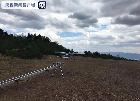
After the Yangbi 6.4 earthquake in Yunnan Province, nine technicians from the UAV Emergency Surveying and Mapping Support Team (Yunnan Basic Surveying and Mapping Technology Center) of Yunnan Provincial Department of Natural Resources rushed to the earthquake area with four UAVs to carry out emergency surveying and mapping support. On the morning of 23rd, the emergency surveying and mapping support team has provided the remote sensing image of unmanned aerial vehicle (UAV) with the resolution of 0.15m in the epicenter area and 0.05m in Xiuling Village, which was seriously damaged, to the earthquake relief headquarters, providing intuitive and fine image data for scientifically judging the disaster situation and formulating post-disaster rescue plans.
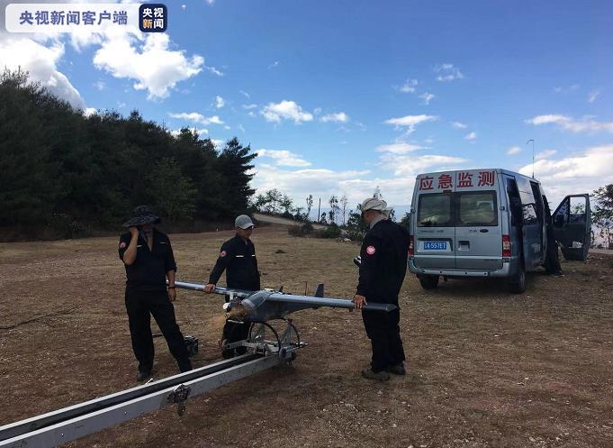
It is understood that the geological conditions in the disaster area are complex, with high mountains and deep valleys, steep and steep, with an average elevation of 2,250 meters within the epicenter of 5,000 meters, abnormal weather changes and low clouds, and the operation of drones is facing great challenges. In order to ensure the safe and rapid acquisition of high-resolution remote sensing image data in the disaster area, technicians worked out a scheme of simultaneous operation of fixed-wing and multi-rotor groups according to the actual situation in the disaster area. The fixed-wing group can realize plane flight and obtain large image area by using the fixed-wing UAV. Through multi-ground station monitoring, it took off and landed in Dali City and Weishan County, 40 kilometers away from the epicenter, flying for 2 hours and 8 minutes, with a range of 250 kilometers, and obtained 80 square kilometers of UAV remote sensing images with a resolution of 0.15 meters in the epicenter area. Another group of multi-rotor groups used the characteristics that multi-rotor aircraft can fly in points and obtain high-resolution real-life three-dimensional images, and went straight to Xiuling Village, which was seriously damaged in the epicenter, and made two flights to obtain 1 square kilometer of UAV remote sensing images with a resolution of 0.05 meters.
After the mission, the emergency surveying and mapping support team processed the UAV remote sensing image data overnight, made special maps, and delivered them to the earthquake relief headquarters at 10 am on the 23rd, which provided important data support for scientific earthquake relief and prevention of secondary geological disasters. (Reporter Li Tengfei, General Desk)